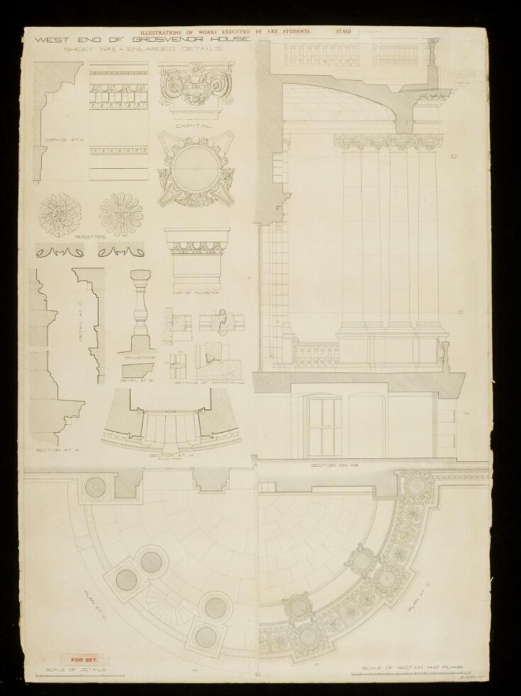

Measured elevation of the west side of Grosvenor House
Drawing
ca. 1884-1885 (drawn)
ca. 1884-1885 (drawn)
| Artist/Maker | |
| Place of origin |
Drawing; inscribed. Measured elevation of the west side of Grosvenor House.
Object details
| Categories | |
| Object type | |
| Title | Measured elevation of the west side of Grosvenor House (generic title) |
| Materials and techniques | Pen and ink and wash drawing on paper |
| Brief description | Drawing by Samuel Carrodus. Measured elevation, plan, section and details of the west side of Grosvenor House. Britain, ca. 1884-1885. |
| Physical description | Drawing; inscribed. Measured elevation of the west side of Grosvenor House. |
| Dimensions |
|
| Subject depicted | |
| Place depicted | |
| Collection | |
| Accession number | D.1352-1903 |
About this object record
Explore the Collections contains over a million catalogue records, and over half a million images. It is a working database that includes information compiled over the life of the museum. Some of our records may contain offensive and discriminatory language, or reflect outdated ideas, practice and analysis. We are committed to addressing these issues, and to review and update our records accordingly.
You can write to us to suggest improvements to the record.
Suggest feedback
You can write to us to suggest improvements to the record.
Suggest feedback
| Record created | June 30, 2009 |
| Record URL |
Download as: JSONIIIF Manifest
