
Map
ca. 1940 (made)
| Artist/Maker | |
| Place of origin |
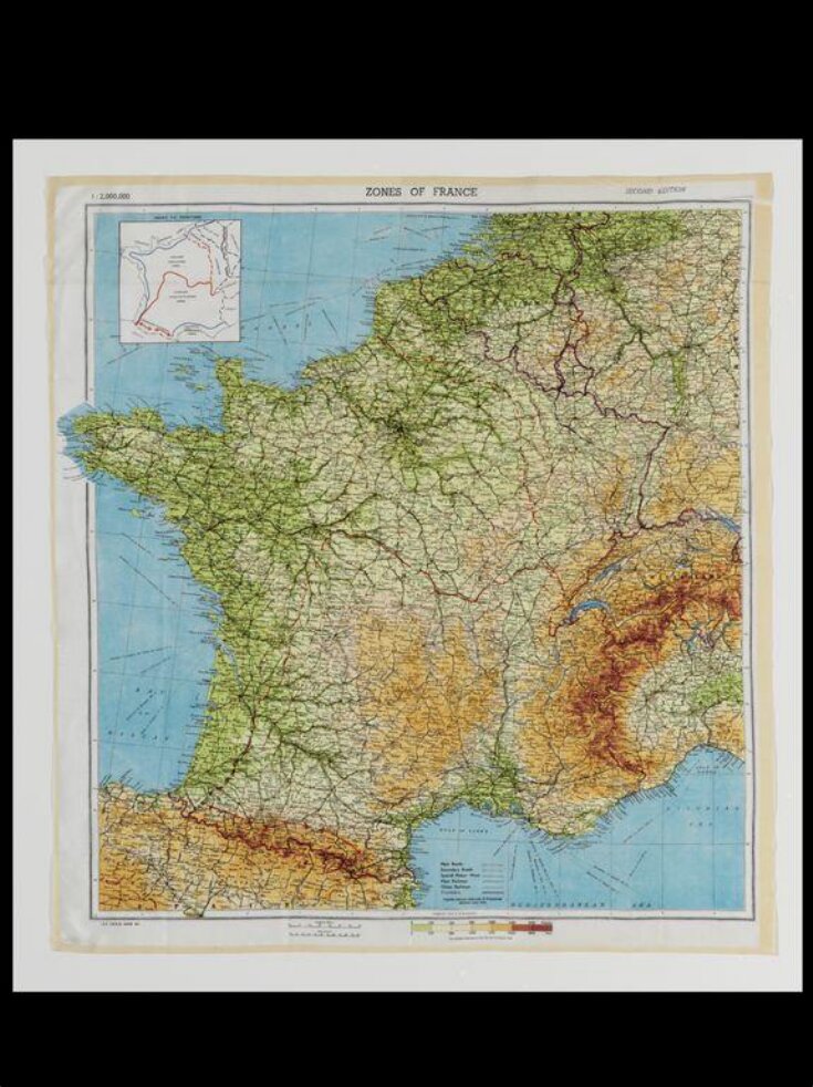
This woven silk map belonged to vivacious London socialite Cecile Tonge Stuart, a licensed aviator who was nicknamed 'Bat' for her busy night life. During the Second World War, silk maps were primarily used by the military. These maps were essential for soldiers to navigate remote areas and were made of silk for its sturdiness. This map appears to have been owned by Stuart for private use.
Object details
| Categories | |
| Object type | |
| Materials and techniques | Printed silk |
| Brief description | Map, printed silk, Britain, ca. 1940. |
| Physical description | Printed silk map. |
| Dimensions |
|
| Credit line | Given by Kim P Sands in memory of Cecile 'Bat' Stuart |
| Summary | This woven silk map belonged to vivacious London socialite Cecile Tonge Stuart, a licensed aviator who was nicknamed 'Bat' for her busy night life. During the Second World War, silk maps were primarily used by the military. These maps were essential for soldiers to navigate remote areas and were made of silk for its sturdiness. This map appears to have been owned by Stuart for private use. |
| Associated objects | |
| Collection | |
| Accession number | T.88-2009 |
About this object record
Explore the Collections contains over a million catalogue records, and over half a million images. It is a working database that includes information compiled over the life of the museum. Some of our records may contain offensive and discriminatory language, or reflect outdated ideas, practice and analysis. We are committed to addressing these issues, and to review and update our records accordingly.
You can write to us to suggest improvements to the record.
Suggest feedback
You can write to us to suggest improvements to the record.
Suggest feedback
| Record created | July 31, 2009 |
| Record URL |
Download as: JSON
