
Map of Oswaldtwistle and Accrington
Design
early 1990s (made)
early 1990s (made)
| Artist/Maker | |
| Place of origin |
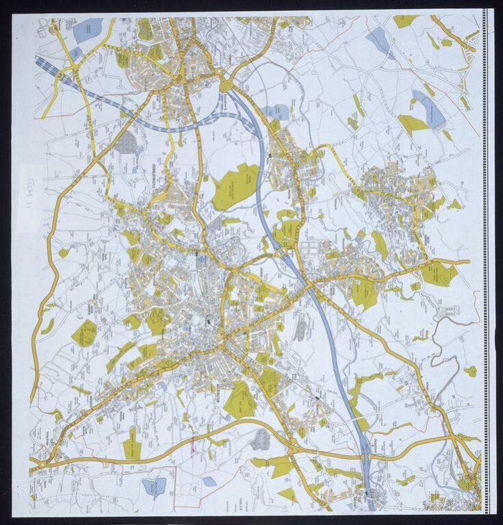
Computer generated colour print on paper showing a map of two inter-related towns with a motorway to the North. Staple holes in corners. Dark pink ink stains close to right edge.
Object details
| Categories | |
| Object type | |
| Title | Map of Oswaldtwistle and Accrington (generic title) |
| Materials and techniques | Colour print on paper |
| Brief description | A computer generated colour map of Accrington and Oswaldtwistle on paper, produced for checking purposes by the Geographers' A-Z Map Company, early 1990s |
| Physical description | Computer generated colour print on paper showing a map of two inter-related towns with a motorway to the North. Staple holes in corners. Dark pink ink stains close to right edge. |
| Dimensions |
|
| Marks and inscriptions |
|
| Credit line | Given by Mrs Phyllis Pearsall MBE, FRGS |
| Subjects depicted | |
| Places depicted | |
| Collection | |
| Accession number | E.862-2003 |
About this object record
Explore the Collections contains over a million catalogue records, and over half a million images. It is a working database that includes information compiled over the life of the museum. Some of our records may contain offensive and discriminatory language, or reflect outdated ideas, practice and analysis. We are committed to addressing these issues, and to review and update our records accordingly.
You can write to us to suggest improvements to the record.
Suggest feedback
You can write to us to suggest improvements to the record.
Suggest feedback
| Record created | September 24, 2004 |
| Record URL |
Download as: JSON
