
A Map of Bradford
Design
ca. 1945 (made)
ca. 1945 (made)
| Artist/Maker | |
| Place of origin |
Drawing in pen and ink and pencil on tracing paper
Object details
| Categories | |
| Object type | |
| Title | A Map of Bradford (generic title) |
| Materials and techniques | Pen and ink and pencil on tracing paper |
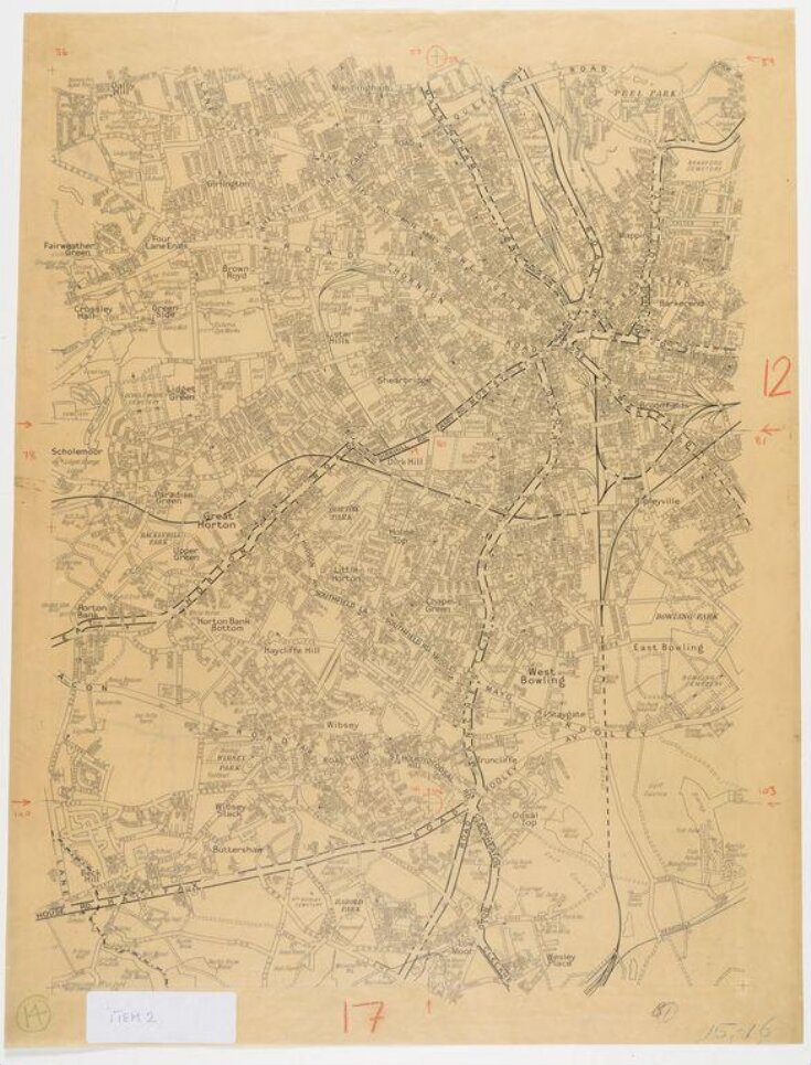
| Brief description | A handrawn map of Bradford suburbs in pen and ink and pencil on tracing paper, prepared for reproduction and publication by the Geographers' A-Z Map Company, about 1945 |
| Physical description | Drawing in pen and ink and pencil on tracing paper |
| Dimensions |
|
| Marks and inscriptions |
|
| Credit line | Given by Mrs Phyllis Pearsall MBE, FRGS |
| Subject depicted | |
| Place depicted | |
| Collection | |
| Accession number | E.860-2003 |
About this object record
Explore the Collections contains over a million catalogue records, and over half a million images. It is a working database that includes information compiled over the life of the museum. Some of our records may contain offensive and discriminatory language, or reflect outdated ideas, practice and analysis. We are committed to addressing these issues, and to review and update our records accordingly.
You can write to us to suggest improvements to the record.
Suggest feedback
You can write to us to suggest improvements to the record.
Suggest feedback
| Record created | September 24, 2004 |
| Record URL |
Download as: JSON
